 Short on time
Guides
Language
EnglishCurrency
US dollar · $GetYourGuide converts to the currency you select here.
Guide · Onward travel
Punta Arenas to Antarctica, and the road to Ushuaia
Punta Arenas is one of the gateways to the white continent and the start of the long road to Ushuaia. Here is how the flights, the cruises and the overland route work, and when each is possible.
Check availabilityfrom $365 · no cancellation fee
Editorial team, puntaarenaswhalewatching.comUpdated October 22, 20266 min read35 sources
Why Punta Arenas is an Antarctic gateway
Punta Arenas has a long link with the far south. The Chilean Antarctic Institute, INACH, was created in 1964 to support scientific research on Antarctica.6 In 2003 it was decentralized and moved to Punta Arenas to strengthen the city as the gateway to the continent.4 The institute's presence is one reason the city's name comes up so often in Antarctic travel.
The city is also one of the ports for Antarctic tourism. The International Association of Antarctica Tour Operators says most cruises depart from gateway ports in southern South America, such as Ushuaia, Punta Arenas or Montevideo, heading for the northern tip of the Antarctic Peninsula.7 Choosing the right gateway depends on whether you want to fly or sail across.
All of this happens under a shared set of rules. The Antarctic Treaty was signed in Washington on 1 December 1959 by the 12 countries whose scientists had worked in Antarctica during the International Geophysical Year, and it entered into force on 23 June 1961.8 Tour operators work within it, which shapes where and how visitors can land.
Overland
Punta Arenas to Ushuaia, leg by leg
Flight from Punta Arenas to Antarctica
The fastest way to the continent is a flight from Punta Arenas to Antarctica. Chile Travel explains that expedition flights land at the Teniente Marsh aerodrome at Base Frei Montalva on King George Island, that the flight takes about 2 hours, and that it is booked through a tour operator.1
Flying has one big advantage. A fly-and-cruise program from Punta Arenas avoids the sea crossing of the Drake Passage, a leg that can take about 48 hours each way.3 Chile's navy describes that route as normally affected by bad weather, with winds over 60 knots and waves of 10 to 12 meters very common.11
The trade-off is flexibility. Flights to King George Island depend on weather at both ends, so build spare days into your plan before and after. Tour operators sell these trips as packages, and they set the rules on what happens if the plane cannot leave on the scheduled day. Travel insurance that covers delays and medical evacuation is worth checking before you commit.
Options
Ways south from Punta Arenas
| Option | How | Time | Season |
|---|---|---|---|
| Expedition flight | Plane to King George Island | About 2 hours | November to March |
| Fly and cruise | Plane, then a ship | Skips the Drake | November to March |
| Classic cruise | Ship from Ushuaia | 10 to 12 days | October to March |
| Road to Ushuaia | Ferry, border, road | A full day | All year |
Times and seasons from Chile Travel and Ushuaia's tourism office; the ferry runs every day of the year.1231213
Three ways
How will you go south?
Short on time Best of both
Fly and cruise
Plane, then ship
- Crossing
- By air
- Season
- November to March
- From
- Punta Arenas
 Classic voyage
Decision helper
Which way to Antarctica?
Choose by time, budget and stomach
Most cruises depart from one of the gateway ports in southern South America, such as Ushuaia (Argentina), Punta Arenas (Chile) or Montevideo (Uruguay), to the scenic and wildlife rich northern tip of the Antarctic Peninsula.
Antarctica cruise from Punta Arenas
An Antarctica cruise from Punta Arenas usually means a fly-and-cruise trip: you fly to King George Island and join a ship there, skipping the open-sea crossing.3 It suits travelers who are short on time or worried about seasickness. It also leaves more of your holiday for landings and wildlife rather than open ocean.
Cruises that sail the whole way leave mostly from Ushuaia. The city's tourism office calls the classic voyage 10 to 12 days long, depending on the ship and the weather, and says 90% of Antarctic tourism calls at Ushuaia before heading south.1215 It puts Ushuaia about 1,000 km from Antarctica.15
Whichever route you choose, the season is short. From Chile it is concentrated in the austral summer, between November and March.2 From Ushuaia the season runs from October to March.12 Those months overlap with the humpback peak in the Strait of Magellan, so a whale day fits neatly before or after an Antarctic trip.14 Book early, because places on the small expedition ships are limited.
Map
From Punta Arenas to the whales, the penguins and beyond
The strait south of the city to Cabo Froward and Isla Carlos III, the penguin islands and Tierra del Fuego, and the wider south from Torres del Paine to Ushuaia.
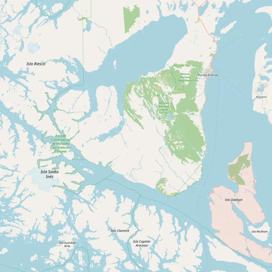 1Punta Arenas2Fuerte Bulnes3San Isidro lighthouse4Cabo Froward5Isla Carlos III
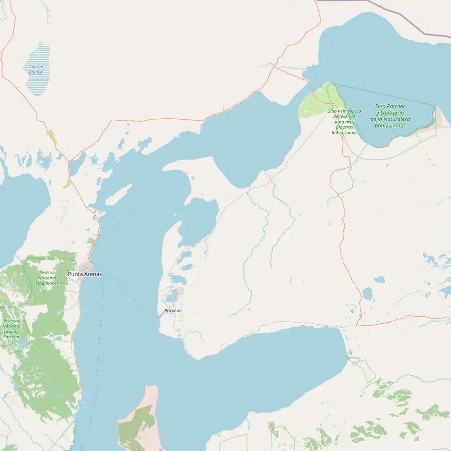 1Punta Arenas6Isla Magdalena7Isla Marta8Porvenir9Parque Pingüino Rey10Primera Angostura
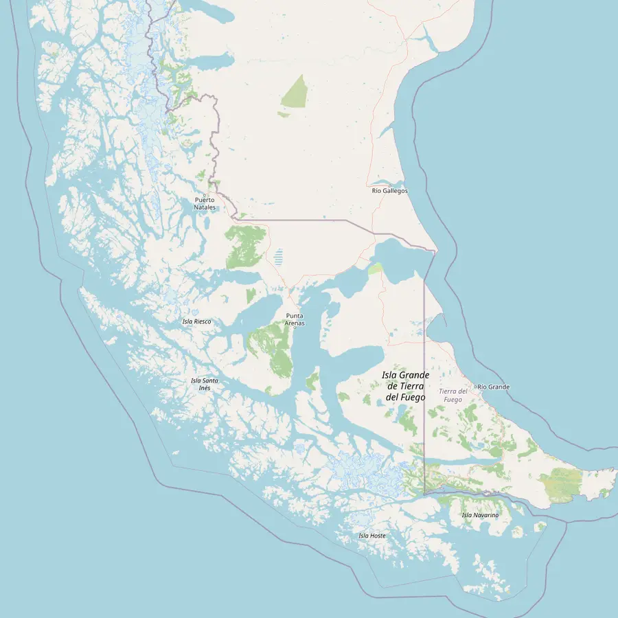 11Punta Arenas airport12Puerto Natales13Torres del Paine14Ushuaia
- 1Punta Arenas
Capital of the Magallanes region, founded in 1848.1617
In Google Maps ↗ - 2Fuerte Bulnes
Inaugurated in 1843; a national Historic Monument 58 km south of the city.1819
In Google Maps ↗ - 3San Isidro lighthouse
70 km south of Punta Arenas and more than 100 years old.20
In Google Maps ↗ - 4Cabo Froward
Where the American continental landmass ends; the whale boat passes it for 30 minutes.21
In Google Maps ↗ - 5Isla Carlos III
Humpback presence around the island peaks from December to March.14
In Google Maps ↗ - 6Isla Magdalena
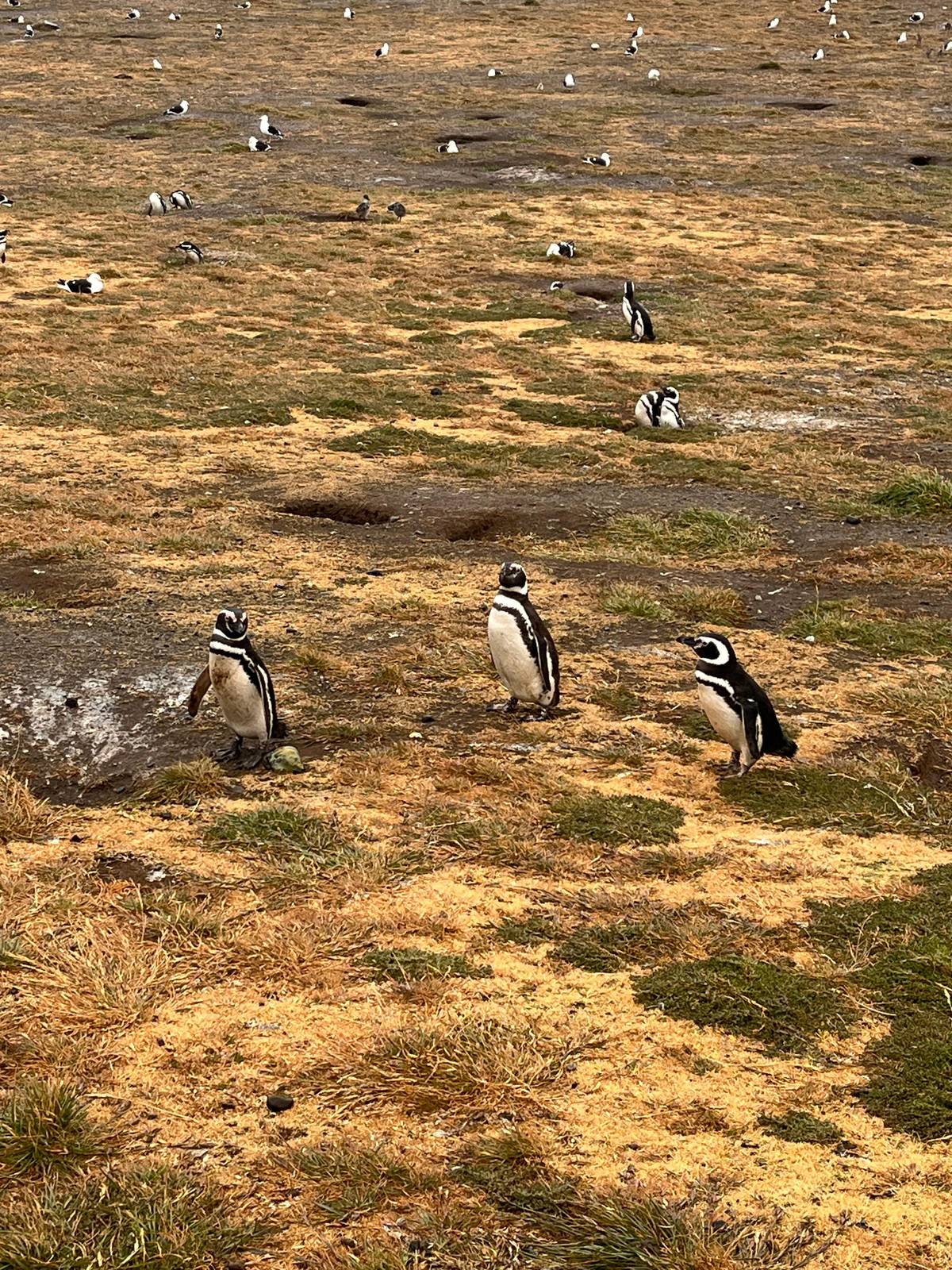
About 7,000 pairs of Magellanic penguins nest here, 35 km northeast of the city.2223
In Google Maps ↗ - 7Isla Marta
Sea lions and imperial cormorants; landing is prohibited.2425
In Google Maps ↗ - 8Porvenir
About 2 hours by ferry from Punta Arenas.26
In Google Maps ↗ - 9Parque Pingüino Rey
King penguins at Bahía Inútil, 115 km from Porvenir.27
In Google Maps ↗ - 10Primera Angostura
The 20-minute ferry crossing to Tierra del Fuego.28
In Google Maps ↗ - 11Punta Arenas airport
20 km north of the city, with daily flights from Santiago.29
In Google Maps ↗ - 12Puerto Natales
About 250 km north of Punta Arenas by paved road.30
In Google Maps ↗ - 13Torres del Paine
National park since 1959, 112 km from Puerto Natales to the Sarmiento entrance.3132
In Google Maps ↗ - 14Ushuaia
293 km beyond the San Sebastián border.5
In Google Maps ↗
Checklist
Heading south from Punta Arenas
01
Plan
- Spare days around any Antarctic flight
- Reach the border before it closes
- Book through a tour operator
02
Bring
- Passport for Argentina
- Warm layers and waterproof trousers
- Motion sickness tablets for the sea
Video
Extreme Flight to ANTARCTICA on an AVRO Jet!
The video stays switched off until you hit play.
Punta Arenas to Ushuaia by road
The trip from Punta Arenas to Ushuaia is a classic Patagonian journey. Ushuaia's tourism office explains that to reach the city by road you must cross the Strait of Magellan, on a ferry service that runs 365 days a year.13 It is a long day, but the landscapes change from steppe to forest and mountains as you go.
On that route the ferry from Punta Delgada crosses in half an hour to Bahía Azul, still in Chile; about 120 km later comes the San Sebastián border, and Ushuaia is 293 km beyond it.5 Chile Travel gives 20 minutes for the Primera Angostura crossing and says the ferry there runs from 8 am until past midnight.289
The border has hours too. The San Sebastián crossing opens at 08:00, exit from both countries closes at 21:40 and entry closes at 22:00.10 Time the day so that you reach it well before closing, with your passport and any vehicle papers ready. Fill the tank and carry snacks, since services along the way are limited.
Crossing the strait and the border
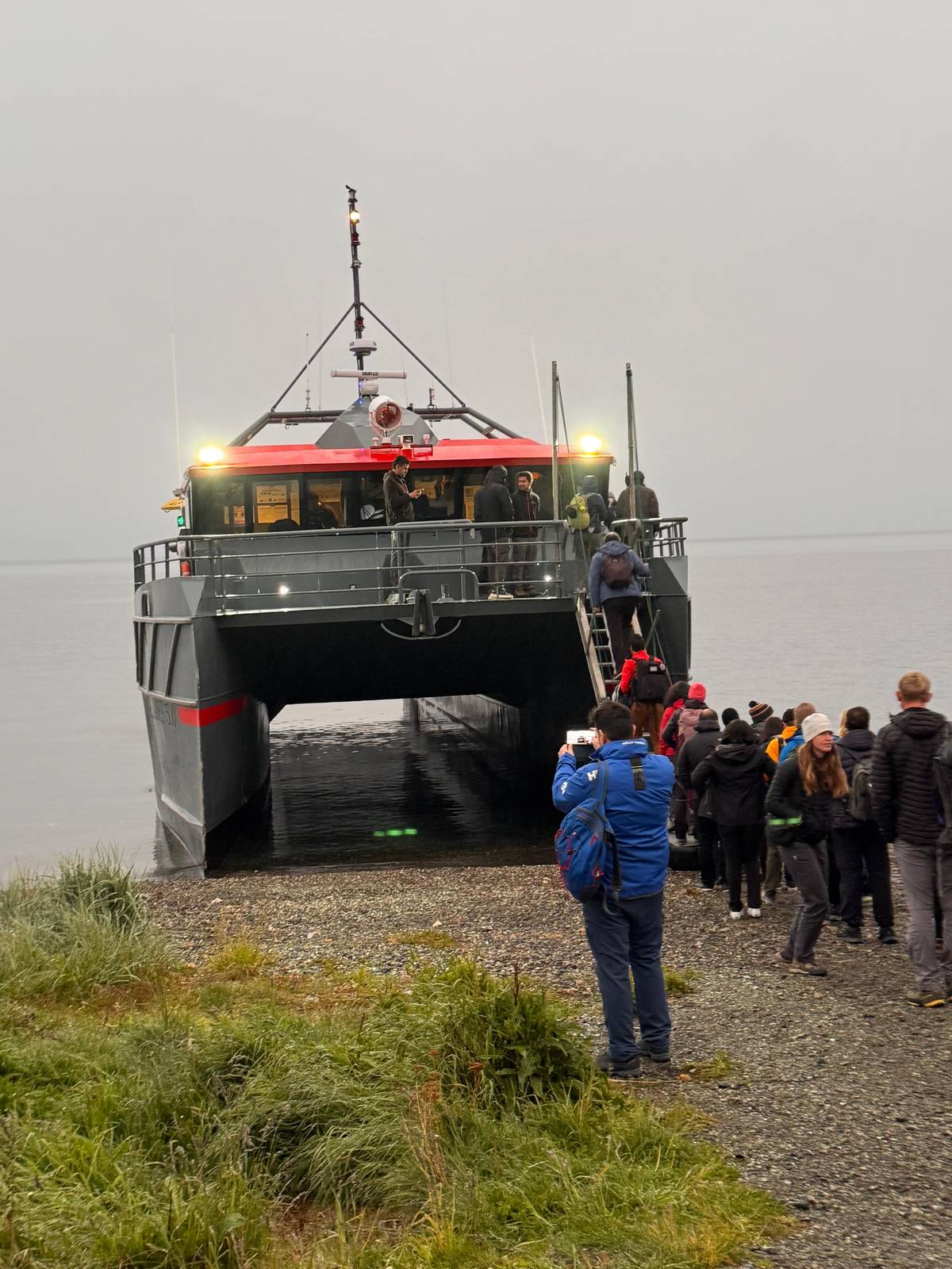
Whether you drive or take a bus, the ferry is part of the adventure. Transbordadora Austral Broom, the company that links Tierra del Fuego with the mainland, runs every day from 08:30 to 01:30, according to Ushuaia's tourism office.33 At the narrows the currents are strong: Chile's navy records currents of up to 8 knots there at spring tides.34
There is also the longer ferry from Punta Arenas to Porvenir, about 2 hours across the strait.26 It has only two departures a day, so it suits a planned trip rather than a spur-of-the-moment one.9 Check the latest schedule before you travel, because departures can change with the weather.
Remember that Tierra del Fuego is shared by Chile and Argentina. You enter Argentina at San Sebastián, and the road on to Ushuaia crosses a very different landscape of forest and mountains as you head south. Allow a full day for the journey, and do not plan a flight from Ushuaia for the same evening.
Questions to ask before you book
Antarctic trips are expensive and weather-dependent, so read the operator's terms closely. Ask what happens if the flight to King George Island cannot leave on the planned day, how many days of delay the price covers, and whether hotel nights in Punta Arenas are included while you wait.
Ask about the landings too. A fly-and-cruise trip and a classic cruise visit different places in different ways, and the operator decides where the ship goes as the weather allows. Find out how many landings are planned, how passengers are divided between them and what clothing the operator lends you on board.
Finally, ask about health and insurance. Remote trips usually require medical forms and cover for evacuation, and seasickness tablets are worth packing even on a fly-and-cruise trip, because the ship still moves. The CDC advises taking them before the motion starts rather than after symptoms begin.35
Fitting Antarctica around the whales
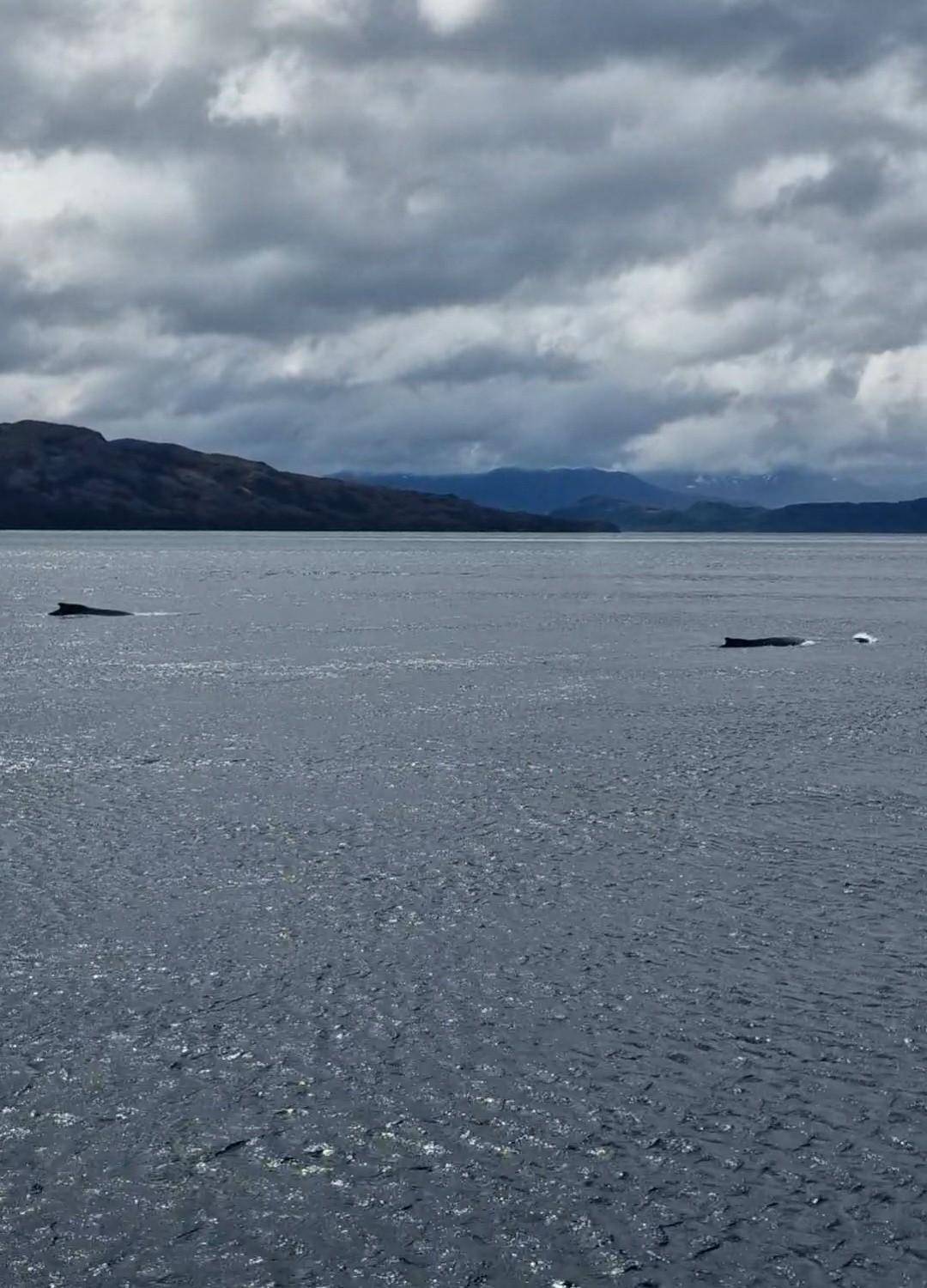
Antarctic trips from Chile run between November and March, the same summer as the whale season, so it is easy to combine them.2 Humpback presence around Isla Carlos III peaks from December to March.14 Book the whale day before your Antarctic departure if you can; if wind cancels it, you still have time to rebook. Ending a southern trip with Antarctica and starting it with the humpbacks makes a memorable pairing.
The booked whale day lasts 12 hours and lists free cancellation up to 24 hours before. That makes it a safe choice for the days around an Antarctic flight, when plans may shift at short notice.
Pack once for both. The layers you need on the strait, warm base, insulating mid-layer and windproof shell, are the same ones you will want in Antarctica. Add waterproof trousers and good gloves, and you are ready for both trips. A warm hat and spare gloves weigh almost nothing and make the biggest difference on deck.
Pick your date
A day with the humpbacks of the strait
Meals, the navigation and a bilingual guide included; cancel for free up to a day before.


You ask,we answer.
How long is the flight to Antarctica?
About 2 hours. Expedition flights land on King George Island.1
When can I go?
November to March from Chile. The tourist season is concentrated in the austral summer.2
Why fly instead of sailing?
To skip the Drake Passage. That crossing can take about 48 hours each way.3
How far is Ushuaia from the border?
293 km. Ushuaia lies 293 km beyond San Sebastián.5
When does the border close?
In the evening. Exit closes at 21:40 and entry at 22:00.10
Do cruises leave from Punta Arenas?
Some do. IAATO names Punta Arenas among the gateway ports.7
How long is a classic cruise?
10 to 12 days. That is the length Ushuaia's tourism office gives.12
Sources
What this text is based on
- 1Chile Travel (Sernatur)Antártica Chilena↩
- 2Chile Travel (Sernatur)Cruceros a la Antártica desde Chile: la puerta al Continente Blanco↩
- 3Chile Travel (Sernatur)Cruceros a la Antártica desde Chile: la puerta al Continente Blanco↩
- 4Memoria Chilena, Biblioteca Nacional de ChileInstituto Chileno Antártico (INACH)↩
- 5Secretaría de Turismo, Municipalidad de UshuaiaCómo llegar - Turismo Ushuaia↩
- 6Memoria Chilena, Biblioteca Nacional de ChileInstituto Chileno Antártico (INACH)↩
- 7IAATO (International Association of Antarctica Tour Operators)FAQs↩
- 8IAATO (International Association of Antarctica Tour Operators)Antarctic Treaty↩
- 9Chile Travel (Sernatur)What to do in Tierra del Fuego↩
- 10Argentina.gob.ar (Vicejefatura de Gabinete del Interior)Centro de Frontera San Sebastián↩
- 11DIRECTEMAR (Dirección General del Territorio Marítimo y de Marina Mercante, Armada de Chile)Strait of Magellan, Chilean Channels and Fiords - Regulations and information for piloting↩
- 12Secretaría de Turismo, Municipalidad de UshuaiaPuerta de entrada a la Antártida↩
- 13Secretaría de Turismo, Municipalidad de UshuaiaCómo llegar - Turismo Ushuaia↩
- 14IUCN Marine Mammal Protected Areas Task ForceWestern Magellan Strait IMMA↩
- 15Secretaría de Turismo, Municipalidad de UshuaiaPuerta de entrada a la Antártida↩
- 16Chile Travel (Sernatur)Cementerio de Punta Arenas, uno de los más bellos de Chile↩
- 17Memoria Chilena, Biblioteca Nacional de ChilePunta Arenas y la economía magallánica (1848-1950)↩
- 18Memoria Chilena, Biblioteca Nacional de ChileEl fuerte Bulnes↩
- 19Consejo de Monumentos Nacionales de ChileFuerte Bulnes y toda la península denominada Punta Santa Ana↩
- 20Chile Travel (Sernatur)Faro San Isidro, una travesía luminosa en el fin del mundo↩
- 21Servicio de Evaluación Ambiental (SEA), Gobierno de ChileSEA Magallanes y Comité Técnico realizan taller en el lugar más austral del continente, Cabo Froward↩
- 22↩
- 23↩
- 24↩
- 25↩
- 26Chile Travel (Sernatur)Porvenir↩
- 27Chile Travel (Sernatur)King Penguin Natural Reserve↩
- 28Chile Travel (Sernatur)Guide for a trip to the home of the King Penguin↩
- 29Chile Travel (Sernatur)Historia y cultura en Punta Arenas (itinerario)↩
- 30↩
- 31↩
- 32Chile Travel (Sernatur)Cómo llegar desde Santiago a las Torres del Paine↩
- 33Secretaría de Turismo, Municipalidad de UshuaiaConexiones de transporte - Turismo Ushuaia↩
- 34DIRECTEMAR (Dirección General del Territorio Marítimo y de Marina Mercante, Armada de Chile)Strait of Magellan, Chilean Channels and Fiords - Regulations and information for piloting↩
- 35US Centers for Disease Control and Prevention (CDC Yellow Book)Motion Sickness↩
Keep reading